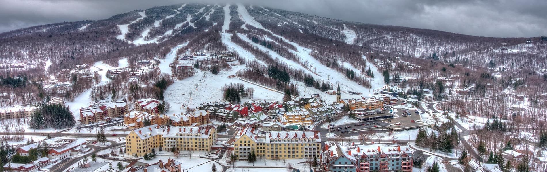
Hiking Around the Mountain
Flat and fun to steep and scenic, find your new trail at Stratton. Ever wonder how Benton MacKaye got the idea to create a footpath from Georgia to Maine? Or what spurred James P. Taylor to map out a trail up the spine of Vermont? Inspiration for both can be traced to the summit of southern Vermont’s highest peak where today the storied Long and Appalachian trails share a route over Stratton Mountain. Explore Vermont with scores of hikes on the mountain and in the surrounding area. A favorite is the .75 mile “beginner” route from the gondola terminal to the Stratton fire tower. Manned until 1979 and one of just a handful left in Vermont; the fire tower reward you with a view that stretches clear across four states and mountain ranges.
View the hiking map to familiarize yourself with the trail locations and difficulty. Please note that Stratton also offers downhill mountain biking. There is no hiking permitted on the downhill mountain bike trails.
Hikes on Stratton
Beginner
BEGINNER LOWER MOUNTAIN LOOP
Old Log Road – Flukey’s Run (Emerald Forest Wooded Trail) – Hemlock – Lower Standard)
This loop features moderate climbs and downhills. Start on Lower Standard for a more challenging route or follow Old Log Road for a warm up or hikes with smaller children. Flukey’s Run segment offers the option of hiking the open trail or venturing into Emerald Forest en route to Hemlock.
– Approximately 1.1 miles round trip.
BEGINNER MAIN BASE – SUNBOWL
Village Walk – Home Run – 91
From base of the Cub Carpet, follow work road to a small pond, underneath “Overpass” straight to “Home Run”. Follow “91” down to Sunbowl base area.
– Approximately 1.85 miles each way.
BEGINNER WANDERER SUMMIT ASCENT
Lower Wanderer – Lower & Upper West Meadow – Mike’s Way
Combination of wooded trails, mowed surface and gravel work road. Lower Wanderer segment offers options of hiking the open trail or venturing into the Moonbeam Trail en route to Lower West Meadow and its picturesque views. The final ascent meanders toward the summit along Mike’s Way.
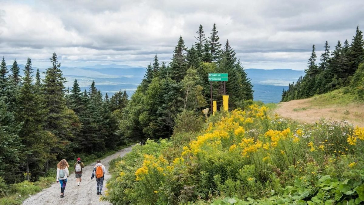
BEGINNER FIRE TOWER TRAIL
The trailhead is marked approximately 50 feet down “Mike’s Way” on left. Follow this trail from the Summit of Stratton to the old Fire Tower, which marks the true summit of Stratton Mountain and the crossing of the Long and Appalachian Trails. Check in with Tower hosts for the latest trail news, or climb the tower for 360 views of the surrounding area.
– Approximately .75 miles each way. Little to no elevation gain.
BEGINNER SUMMIT LOOP
Starting from the large wooden bear on the summit there is a blue bamboo pole. Follow the orange & black bamboo poles to the left from there for a short and fun hike around the summit. Includes a lookout tower and beautiful eastern views from the top of “Upper Kidderbrook.”
– Approximately .7 miles round trip
Intermediate
INTERMEDIATE LOWER MOUNTAIN LOOP
Village Walk – Home Run – Shortcut Big Ben – Old No. 8 – Grizzly Access – Underpass – Lower Standard – Hemlock – Flukey’s Run – Old Log Rd.
From base of the Cub Carpet, follow work road to a small pond, underneath over pass straight to “Home Run”. Stay straight to top of “Big Ben” then right to “Short Cut Big Ben” to the top of the Solstice chairlift. Follow the work road to the right, down towards Ursa lift, left on “Grizzly Access” towards mid-mountain lodge. Down under the Gondola, left on “Hemlock”, right on “Flukey’s Run”, right on “Old Log Road” and back to the base area.
– Approximately 2.9 miles round trip.
INTERMEDIATE MID MOUNTAIN LOOP
Yodeler – Mid Mountain Lodge – Overpass – Lower Standard
This Mid-Mountain loop features mowed trail surfaces. It begins with a direct climb to the Mid-Mountain Lodge via Yodeler. Continue up through overpass before beginning the decent on Lower Standard. (Note: You may also incorporate the Old Log Road – Flukey’s Run – Hemlock portion of the Beginner Loop).
– Approximately 2.3 miles round trip.
INTERMEDIATE SUMMIT MEADOWS ASCENT
Lower Standard – Interstate – Upper West Meadow – Mike’s Way
Begins with a direct climb to the Mid-Mountain via Lower Standard. Continue up and across on Interstate before beginning uphill onto West Meadow. Keep right as you near the summit onto Mike’s Way.
– Approximately 1.8 miles each way.
Advanced
ADVANCED SUMMIT STANDARD ASCENT
Lower Standard – Upper Standard
This mowed route follows the Gondola straight up the face of the mountain. Expect to find a series of steep pitches as you climb Upper Standard. If you would like a more mild warm up before the Upper Standard segment, begin on the Lower Mountain Beginner Loop via Old Log Road – Flukey’s Run – Hemlock.
– Approximately 1.4 miles from bottom to top
ADVANCED SUMMIT BLACK BEAR ASCENT
Yodeler – Yodeler Express – Runaway – Old No. 8 – Black Bear – Chute
Black Bear vistas deliver excellent views across the valley. Enjoy the flats across Runaway before the main ascent. The pitch kicks up a notch as you climb Old No. 8 and Black Bear. Approaching the summit on Black Bear signs will direct you through a wooded trail to the lookout tower, an ideal vantage point. Catch your breath, enjoy a sandwich on top of the world, and be sure to snap a picture.
– Approximately 2.1 miles from bottom to top.
Hiking Hints
Your feet are the key to unlocking the mountains. Hiking Stratton unlocks sunrises, stunning views, exercise, photo opportunities, memories and more. Treat your feet right to make the most of your day. Stratton relies on Smartwool hiking socks to keep our feet happy and our days memorable. Smartwool is the premier hiking sock for a day hike and can be found at First Run in the Village. Visit First Run in Stratton Village for all of your outdoor essentials.
Before setting out on any hike, be sure to have the following essentials:
• Sturdy footwear – sneakers, trail shoes or hiking boots
• Water – the general rule for how much water to bring when hiking is as follows: Adults: 2 cups (500 ml) of water for every 1 hour of hiking. Children: 1-2 cups of water for every hour of hiking. In hot or humid conditions, double this amount per hour
• Hat
• Sunglasses
• Sunscreen
• Layered clothing – weather can change quickly in the mountains
• Snacks
• Hiking Map